Friday, April 12, 2013

Flat Rambler Returns Home #flat_rambler


Tomorrow, Flat Rambler will tuck herself into a brown box and fly back to Iowa:


I've been to the coulee
and Grand Coulee Dam

I've hovered over the big Dry Falls
Held gently with a steady hand

I danced in school to the Harlem Shake
And walked carefully in the coulee, avoiding snakes.

I've stood below the tallest trees
and viewed Mt Index, cold with a breeze

But after awhile, I missed Katelyn and the cattle on the ranch;
especially when I met Shane, world bull-riding champ.

So I'm headed home to Iowa State
Thanks for the journey, to my friend Kate.


Tuesday, April 2, 2013

Ramble with the Best


We rambled with the best tonight, at the Ridge Riders Saddle Club banquet.


I got the cute goodie bags filled with mints.

This rodeo club sponsors our Colorama Festival and Rodeo. As you can see, our Colorama Rodeo in Grand Coulee is the 2012 Pro-West Rodea of the Year!


What an honor: I am in the company of queens!

Left, Miss Colorama Rodeo Queen Erin Wieldraayer and Right, Miss Coulee City Rodeo Queen Caelan Pitts


And, of course, the area is proud of the home-grown champions.


Shane Proctor (and his mom) graciously posed with me, a Flat Rambler. Shane is 2011 PRCA bull riding world champ and five time PBR world finalist. He is in town to put on a bull riding school for the future bull-riders! Giving back is part of what champions do!


Wowser! I've been ramblin' all over Washington, but this day with the Ridge Riders, their queens, and this champion cowboy certainly puts a smile on my face for the honor of being accepted here. Thank you, Erin, Caelan, and Shane!

Thank you, Katelyn for sending me to Coulee Dam!

Ramble at the Grand Coulee Dam


Over a mile long, from where I stand now, it just doesn't look big. But The Great Pyramid is four times smaller than the base of the dam!

Watch  the dam spill its water. Learn about the irrigation and power of the Grand Coulee Dam.  (PBS American Experience here and here).  Read the story here.


And above -- the power lines bringing us electricity.


Desert, Volcanoes, Floods, and Pirates!


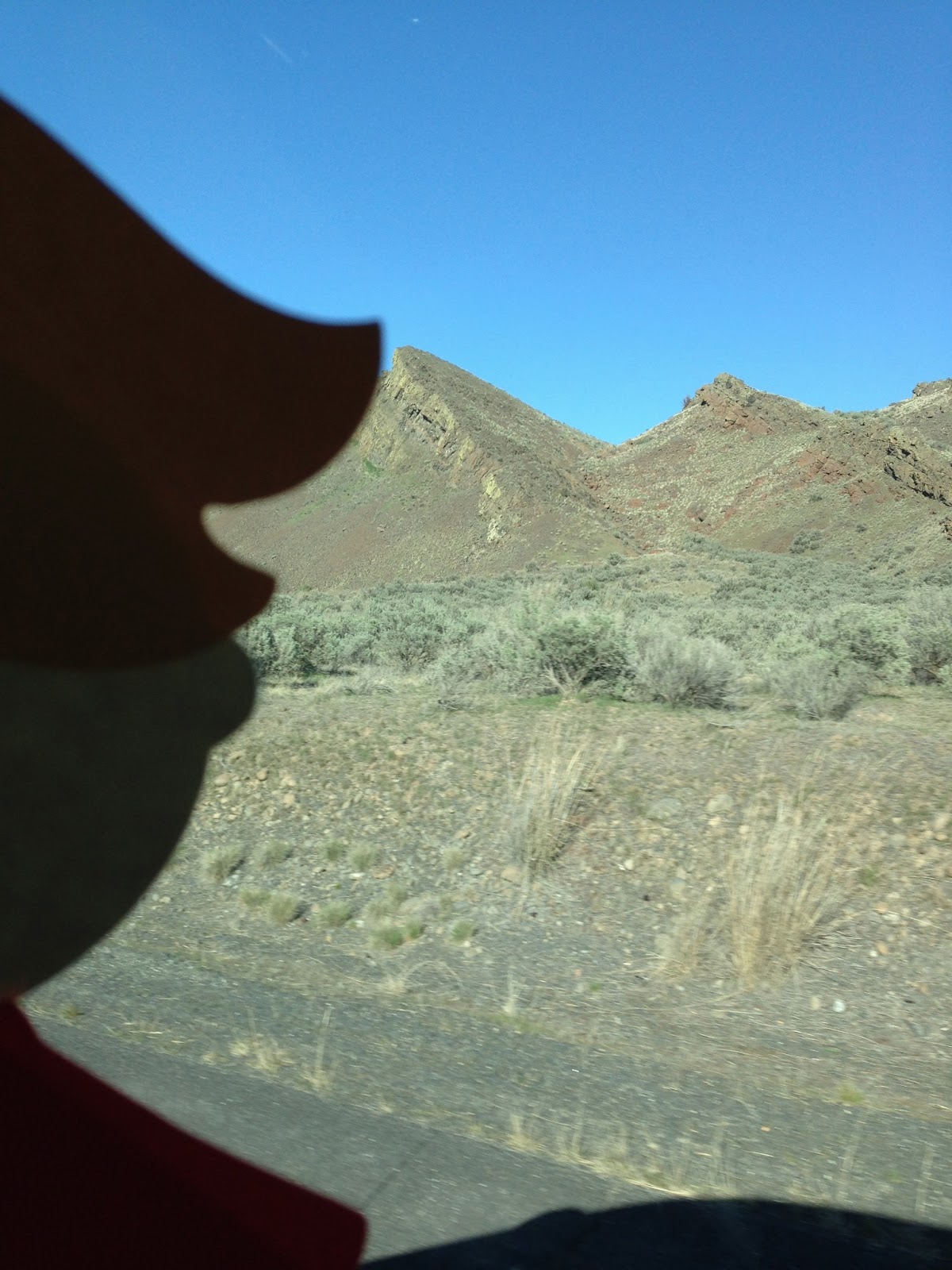
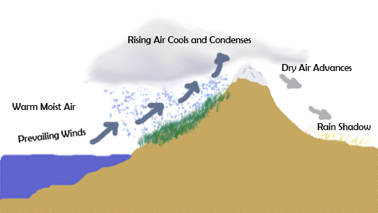
Now we've made it over the mountains and are now in Eastern Washington. Notice: no trees -- it is DRY over here. All the rain fell on the west side of the mountains because of the rainshadow effect.  Also, where the west side has temperate weather all year (40s in winter; 80s in summer), we experience below zero weather and often snow in the winter and 100 degree weather in the summer!


We stop for sustenance at the Sundial Bistro in Soap Lake. The sculpture above was in the parking lot. 
Down the road from the restaurant, along the edge of Soap Lake, we visited the famous Sundial Sculpture by local artist Keith Powell
We saw an old roadster parked by the sundial a pirate ship floating on the lake!


In Soap Lake, we really noticed the amazing landscape. Millions of years ago in southeastern Washington, lava oozed out of the ground for millions of years (video) -- forming two mile high layers of basalt columns. 

Then, when the glaciers covered much of the Northern Hemisphere, glacial floods occurred when the glaciers melted. Those floods began near Missoula, Montana and spread across Washington (video) out to the ocean. This happened at least forty times. And you know what water does? It erodes the land, and in this case, it eroded the basalt layer, forming coulees with high cliffs.

Eastern Washington: semi-arid desert ! The opposite of Western Washington. Below is Dry Falls, formed by that ancient melting glacier in Montana whose flood reached here over 40 times, creating the world’s largest (now dry) waterfall and the Grand Coulee.

Let's visit these results of the both floods, one of lava and one of water:


This is the Coulee Monocline -- see how the land is slanted? Millions of years ago, the lava that oozed out of the ground, forming layers of basalt left a huge empty cavern in the earth. The weight above ground tipped the basalt layer, and this is an example.  Here is an online book about the Spokane Flood.


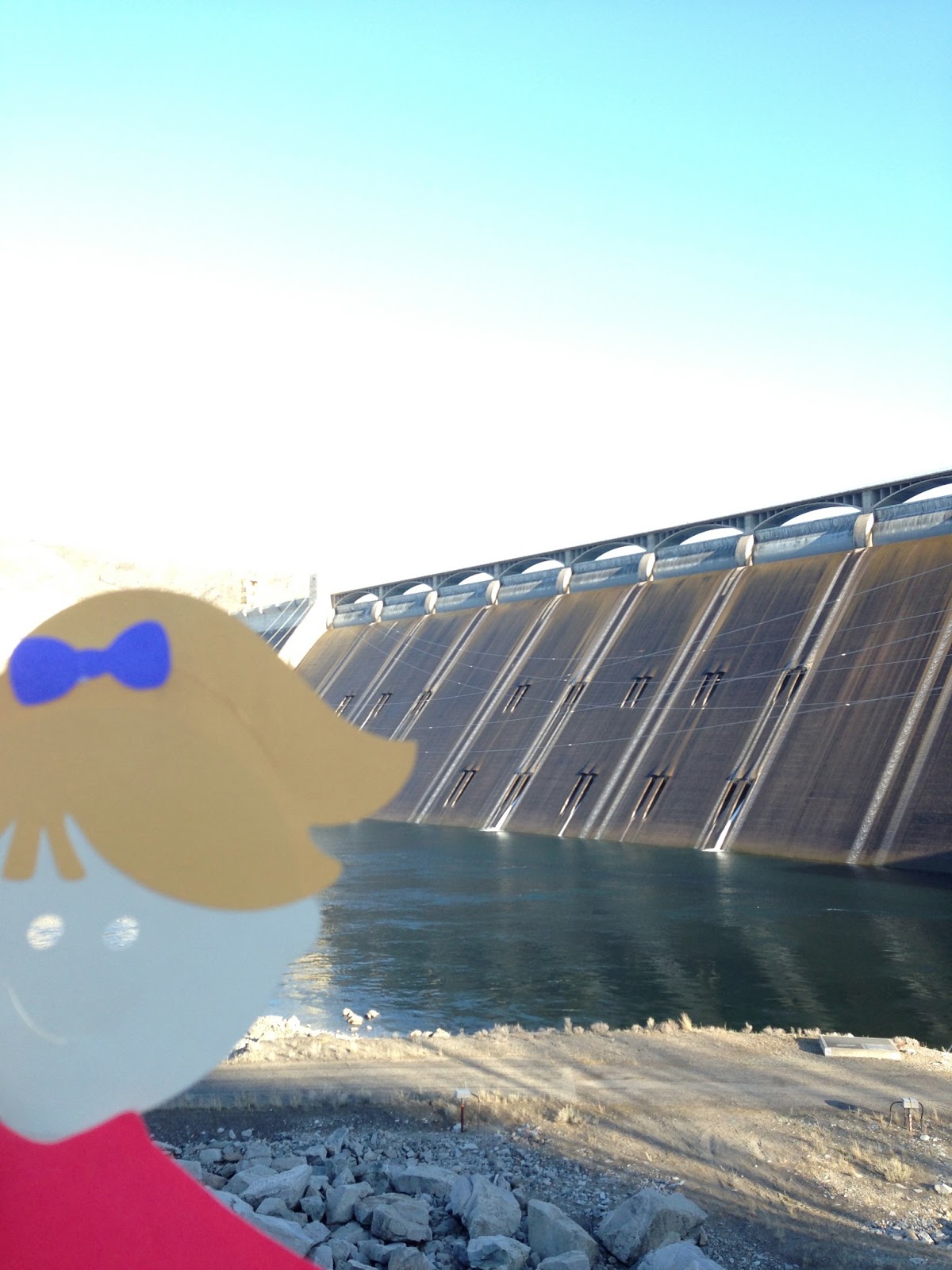
Water from the Columbia River is pumped from Grand Coulee Dam into the Grand Coulee for irrigation and to save to pump back through the dam when more electricity is needed.  That creates Banks Lake, a mecca for fishing and boating -- thirty miles long.


See the tall basalt cliffs.


And this landmark is Steamboat Rock. At the right edge in the picture are huge granite formations. When the giant flood hit the granite, which is harder than basalt, the waters parted around and left this huge landmark, now a state park. Herds of deer roam the top, and people hike up there. Watch out for rattlesnakes. 


Pooka cannot stand it. She goes for a swim in the coulee.

Staying Warm on Stevens Pass


Stevens Pass Ski Resort. Stevens Pass elevation is 5,845 feet.


Leavenworth, the alpine village of Washington.

Heading east, we stop in Leavenworth, a town snuggled in the mountains with architecture like the Alpine Alps! Even McDonalds!


See the rushing river and charred forest along the Wenatchee River?


Money Creek

We rumbled through the Mt. Baker-Snoqualmie National Forest at Money Creek Campground. This is an old growth forest filled with mystery. 

I tried to climb up. Luckily, I'm light-weight and can hang on to the ferns and moss growing on this tree. The forest here is filled with Pacific silver fir, western red cedar, Alaskan yellow cedar, I think.  But perhaps you can figure it out in this brochure. These trees are in the Crest of the Cascades on the west side where lots of rain and few fires allow the vegetation to flourish, as you will see in these pictures.

Looking up from  the same spot, I feel even smaller than usual!

See?

I try another one --- can you believe how tall these grow?

It is so wet, sometimes another tree grows on the side of one already growing!


We're still up in the mountains, so snow is all around.

It's spring though! New growth!

Yes, this is growing right on the tree!

See?

Two trees grow from the stump of another.

It's magical.

Trees fall, and more grow right on top.


Can you count the rings?  These are very old trees. Hundreds of years old.

Money Creek bubbles nearby.


Look at this!  One tree fell, and another grew right on top of it! This is called a nursery log.

Washington State is so wet on the west side, that it has several temperate rainforests

Look up “rainshadow effect” and you will discover why Western Washington is WET and Eastern Washington is DRY.

Image from Public Domain

After reading about the rainshadow effect, can you uses the diagram above to explain it to me?

In Washington State, you can see the ocean, a  temperate rainforest,  a desert, and shrub-steppe sagebrush and grasslands as you drive across!